Welcome to our services page where we offer a range of drone services including Aerial Photography, Mapping and Surveying, and Inspections and Monitoring.

Aerial Photography
Our Aerial Photography service provides stunning aerial images and videos for various purposes such as real estate, events, and marketing.
Our Aerial Photography service guarantees high-quality imagery and customized packages tailored to your needs.
- High-quality imagery
- Professional equipment
- Customized packages
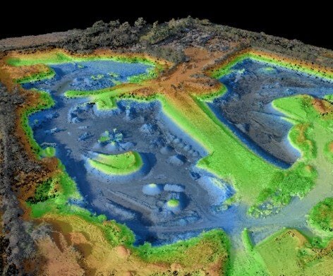
Terrain Mapping and 3D Models
Create precision digital twins of terrain, buildings, structures and interactive 3D models with accurate geometry for precise measurements, calculations and site engineering.
- High-quality imagery
- Professional equipment
- Customized packages
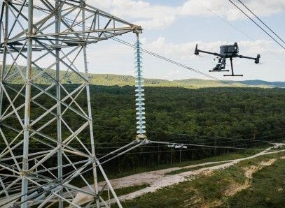
Inspections and Monitoring
Our Inspections and Monitoring service ensures safety and efficiency by conducting inspections of buildings, infrastructure, and equipment from above.
For safety inspections, compliance monitoring, and maintenance checks, trust our Inspections and Monitoring service.
- Safety inspections
- Monitoring compliance
- Maintenance monitoring
“I was impressed by the professionalism and quality of the aerial images provided by Central Queensland DroneServices. Highly recommend their services.”
John Lawson